
Quantum LensPassiveLogic
Create an accurate and fully defined digital twin using technology that’s in your pocket. Then use that digital twin to design, build, operate, and manage your projects with the PassiveLogic ecosystem.
Vendor
PassiveLogic
Company Website
Product details
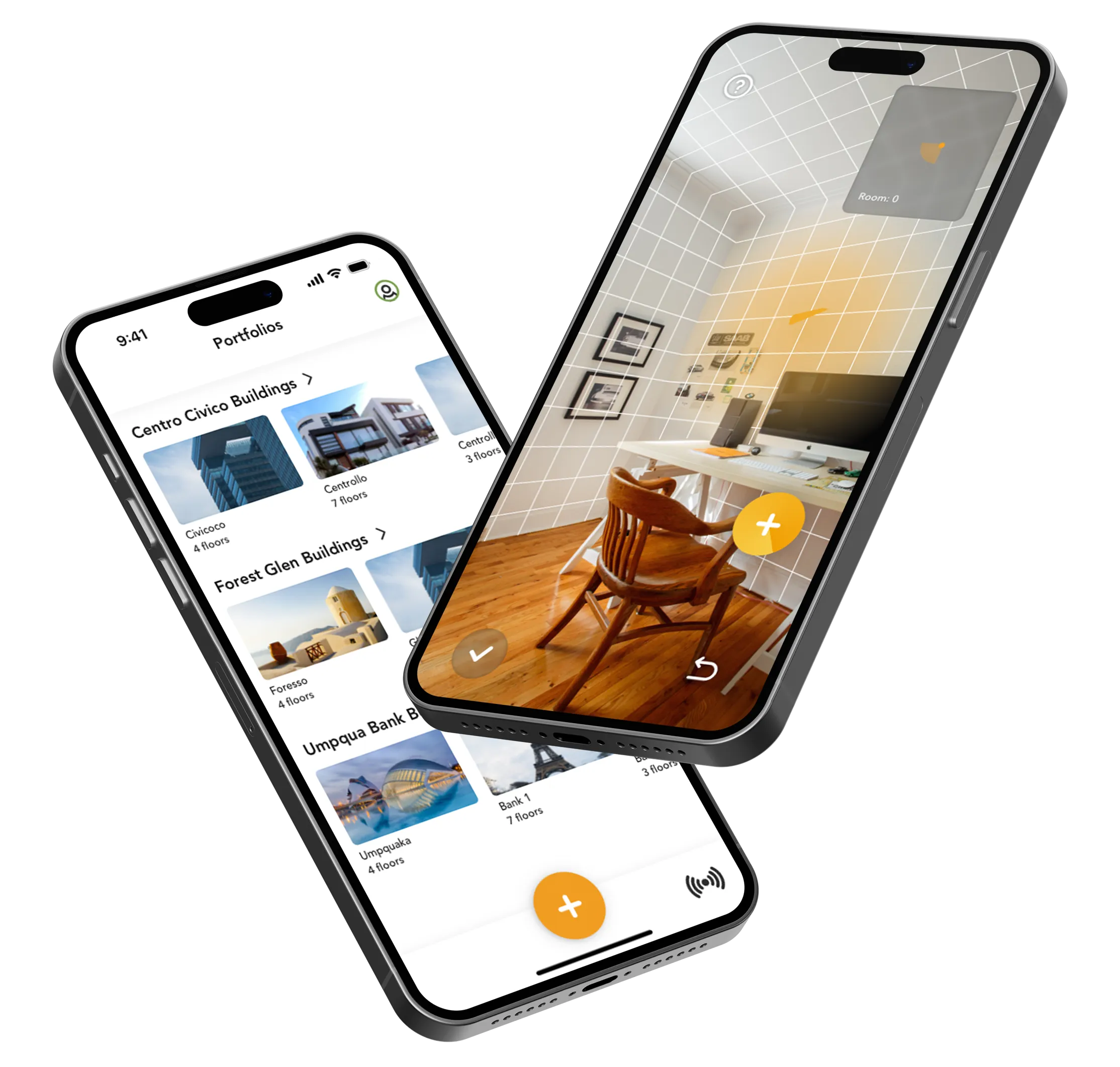
Quantum Lens by PassiveLogic is a mobile-first solution that enables users to create fully defined digital twins of buildings using the lidar scanning technology built into their smartphones. Designed for professionals in architecture, construction, facility management, and operations, Quantum Lens simplifies the process of capturing, inspecting, and managing spaces through real-time augmented reality and secure data workflows.
Features
- Smartphone-Based Scanning: Use built-in lidar to scan spaces and generate digital twins in minutes.
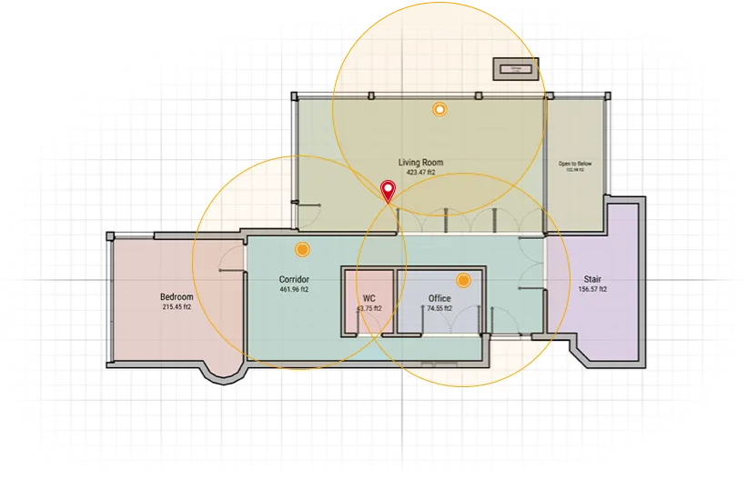
- Quantum Data Model Integration: All scan elements are linked to a fully defined Quantum data model.
- Point of Interest (POI) Logging: Select and annotate objects during scans to track and store spatial data.
- Automated Geometry Processing: Automatically refines angles and geometry for accurate models.
- Augmented Reality (AR) Inspection: View real-time operational data overlaid on your environment.
- Sensor Network Integration: Communicates with PassiveLogic sensors for precise location tracking.
- Custom Site Simulation: Manually define terrain, foliage, and surrounding buildings for specialized simulations.
- Secure Wireless Data Transfer: Sync data between cloud and air-gapped systems via smartphone.
- Portfolio Management: Manage multiple buildings and projects from a single mobile interface.
- QuantumSync Ecosystem: Seamless integration with PassiveLogic’s full suite of applications for end-to-end workflows.
Benefits
- Rapid Deployment: Scan and generate digital twins without scheduling or site prep.
- Enhanced Accuracy: Refined geometry and trilateration ensure precise spatial models.
- Operational Efficiency: Replace manual inspections with real-time AR insights.
- Scalable Use Cases: Suitable for any building size or complexity.
- Improved Collaboration: Share and update models across teams and applications.
- Secure Control: Manage data transfer securely and on your terms.
- End-to-End Integration: Move from design to operation within a unified ecosystem.
Find more products by industry
ManufacturingUtilitiesReal EstateProfessional ServicesConstructionInformation & CommunicationView all