
PropellerPropeller
With Propeller, you can unify your plans, field data, machines, and people on a single map — from ground to cloud. Get the job done right the first time, every time.
Vendor
Propeller
Company Website
Product details
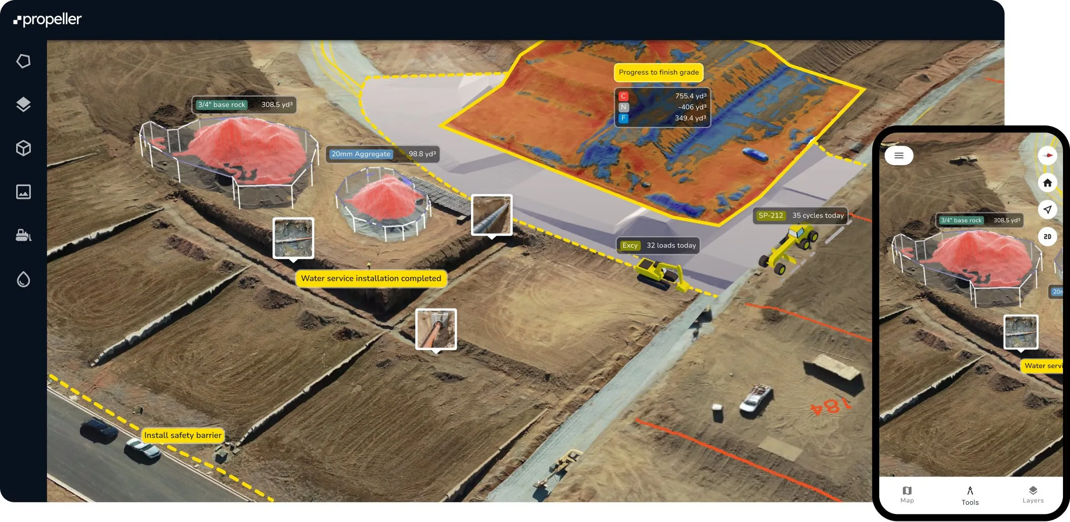
Propeller is a geospatial platform designed to centralize and streamline project data for construction, mining, waste management, and surveying industries. It enables teams to unify plans, field data, machines, and personnel on a single interactive map—from ground to cloud—ensuring accurate, efficient, and collaborative site management.
Features
- Unified Data Hub: Manage design surfaces, plans, surveys, and field data in one platform.
- Collaboration Tools: Share context and insights instantly across teams with complete transparency.
- Survey Analysis: Use data from drones, GPS rovers, laser scanners, and more to calculate volumes, measure elevations, and compare site conditions.
- Daily Progress Tracking: Monitor pace, productivity, and remaining tasks with daily insights.
- Integrations: Compatible with Trimble Connect, Procore, Autodesk BIM 360, Aconex, OneDrive, AutoDesk Build, and HCSS.
- Data Import Support: Accepts formats like TTM, DXF, XML, LAS/LAZ, GeoTiff, PDF, JPG, PNG, and more.
- Advanced Tools:
- Distance and elevation measurement
- Cross-section generation
- Surface area and stockpile volume calculation
- Shrink/swell calculator for soil
- Automation: AI-powered workflows for stockpile measurements and terrain cleanups.
- Private Workspaces: Control access and data sharing within organizations.
- Public API: Query site and survey data for integration with CAD and GIS platforms.
- Web-map Tile Service: Stream orthophotos directly to GIS software.
Benefits
- Productivity Boost: Eliminate repetitive tasks and streamline workflows.
- Accuracy & Insight: Real-time data and automated analysis improve decision-making.
- Scalability: Propeller Scale supports large teams with enhanced security and organization.
- Ease of Use: Fast data processing and intuitive tools reduce complexity.
- Hardware Integration: AeroPoints and DirtMate enhance drone survey accuracy and machine tracking.
Find more products by industry
Water & Waste ManagementMining & QuarryingProfessional ServicesConstructionInformation & CommunicationView allFind more products by category
Enterprise Resource Planning (ERP) SoftwareDevelopment SoftwareIndustrial SoftwareAnalytics SoftwareView all