
Improve productivity and collaboration by making the 4D digital context available to the team from your local server or from the cloud. Share a single view of truth of your reality data.
Vendor
Bentley Systems
Company Website
Publish And Share Unlimited Volumes Of Reality Data
Improve productivity and collaboration by making the 4D digital context available to the team from your local server or from the cloud. Share a single view of truth of your reality data.
Manage and Share Reality Data
Share individual or a combined set of projects Publish and share multiple reality datasets at the same time to give insights in a diverse set of captured projects. Set user permissions and monitor usage Manage user credentials to publish content in a predefined environment. Easily view login data and monitor usage.
Publish and Share According to Users’ Needs
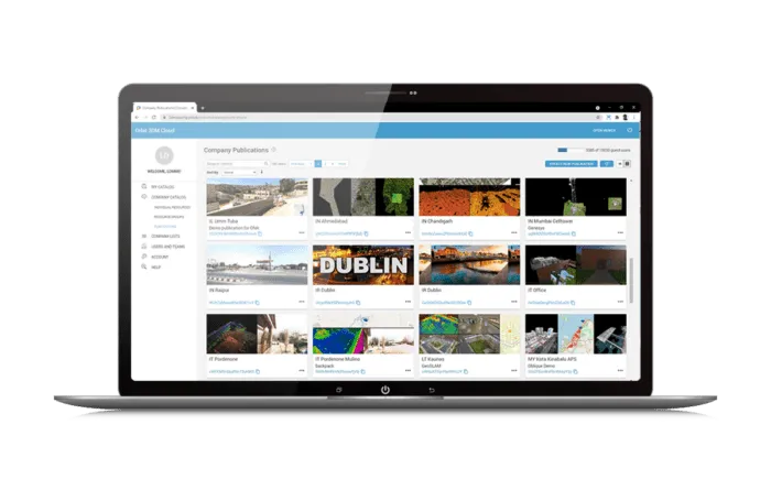
Manage online sharing Aggregate different reality data resources, base maps, and other reference resources into ready‐to‐use publications using a user-friendly console. Set publication properties Manage user credentials and publish content in your software environment. Easily view login data, configure web pages, and generate direct web links. Customize publication Address the exact needs of your users by adding metadata, configuring the view compositions and resources presentation, and specifying available features.
View, Analyze, and Extract Data in a Web Browser
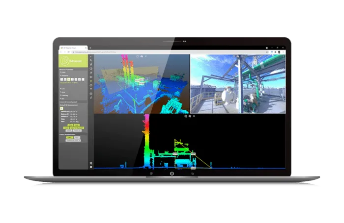
View, Measure and Extract View shared data in a web browser to quickly measure, attribute, and extract points, lines, areas, and download the results for export. Analyze over time Combine and compare mapping data over time, display time lapses, slice through data and annotate the differences to collaborate. Share views among users Save personal views and results and share them with stakeholders to collaborate based on online shared reality data.
Embed shared data in 3rd party software
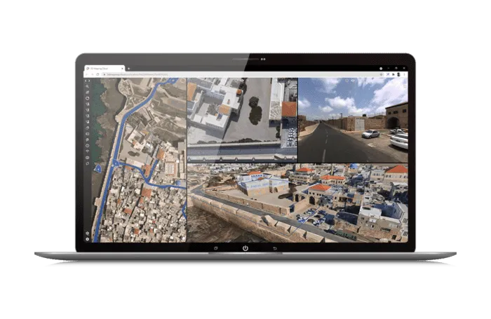
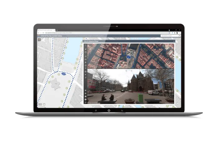
Share data or embed in a 3rd party software Leverage a standard web viewer, or easily integrate plug‐ins for your workflows via the API/SDK, or work via one of the available 3rd party software plug‐ins (ArcMap, ArcGIS Online, ArcPro, MicroStation, QGIS, etc.). Overlay vector data and save measurements in 3rd party Overlay local stored files in the Orbit plugin. Once measurement is done, copy and save the result in your 3rd party software environment.