
OpenCities PlannerBentley Systems
OpenCities Planner lets you design and visualize digital cities to improve communication on your project.
Vendor
Bentley Systems
Company Website
PDS-OpenCi…-LTR-EN-LR.pdf
Product details
What Is Opencities Planner?
OpenCities Planner lets you design and visualize digital cities to improve communication on your project.
- Easily Share Information to the Web, Mobile, and Showroom Displays
- Improve communication in infrastructure and urban development projects with OpenCities Planner
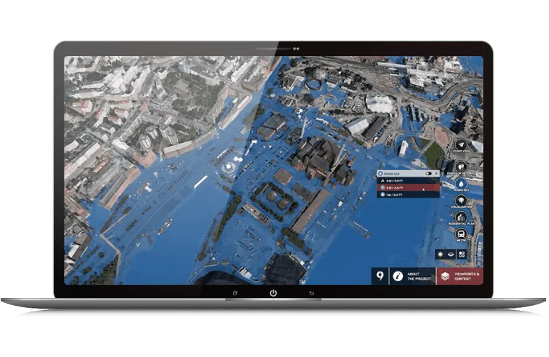
- Detailed Views of Your 3D Data
- Advanced data configuration features support setup, maintenance, and the ability to combine unlimited-sized data sets from files, web services, or databases to make them available within OpenCities Planner
- Get Started Quickly with this Easy-to-use Application
- A subscription and web browser are all that is required
Build your digital twin from existing engineering, spatial data, and enterprise information
- CAD & BIM Models
- Incorporate CAD and BIM models into your digital twin
- Spatial Data
- Bring together GIS and map data for precise spatial context
- Enterprise Information
- Connect additional data such as project planning and operational information
Gain new insights into planning and operations data
- Visualize 3D Imagery
- Integrate precise 3D reality meshes and point cloud data.
- Integrate CityGML
- Visualize CityGML geometry and semantic data.
- Build Visualizations
- Create, visualize, and analyze scenarios with your 3D digital twin.
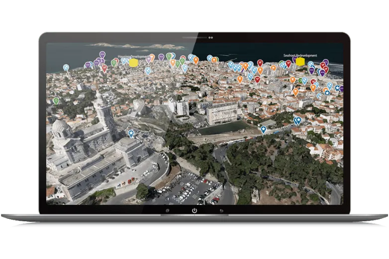
Accelerate and expand feedback and approvals
- Access It Anywhere View your digital twin on mobile, tablet, desktop, and VR/AR devices, as well as large touch-screens.
- Crowdsource Ideas Enable stakeholders to offer feedback through polls, surveys, and pins.
- Build and Visualize Plans Create and share 3D urban plans to improve communication among your teams.
Find more products by industry
UtilitiesProfessional ServicesConstructionInformation & CommunicationView all