
Geophysical software for processing, filtering, and interpreting survey data. Oasis montaj is industry-standard software for geophysicists to process, filter, and model geophysical survey data.
Vendor
Seequent
Company Website
Overview
Oasis montaj is industry-standard software for geophysicists to process, filter, and model geophysical survey data. It enables users to create reliable subsurface interpretations by integrating large geophysical datasets with other geoscience data in a user-friendly application. This software is ideal for geophysicists and geological survey bodies in the mineral resources, energy, environmental, or on/offshore infrastructure industries who require accuracy, power, and versatility.
Oasis montaj
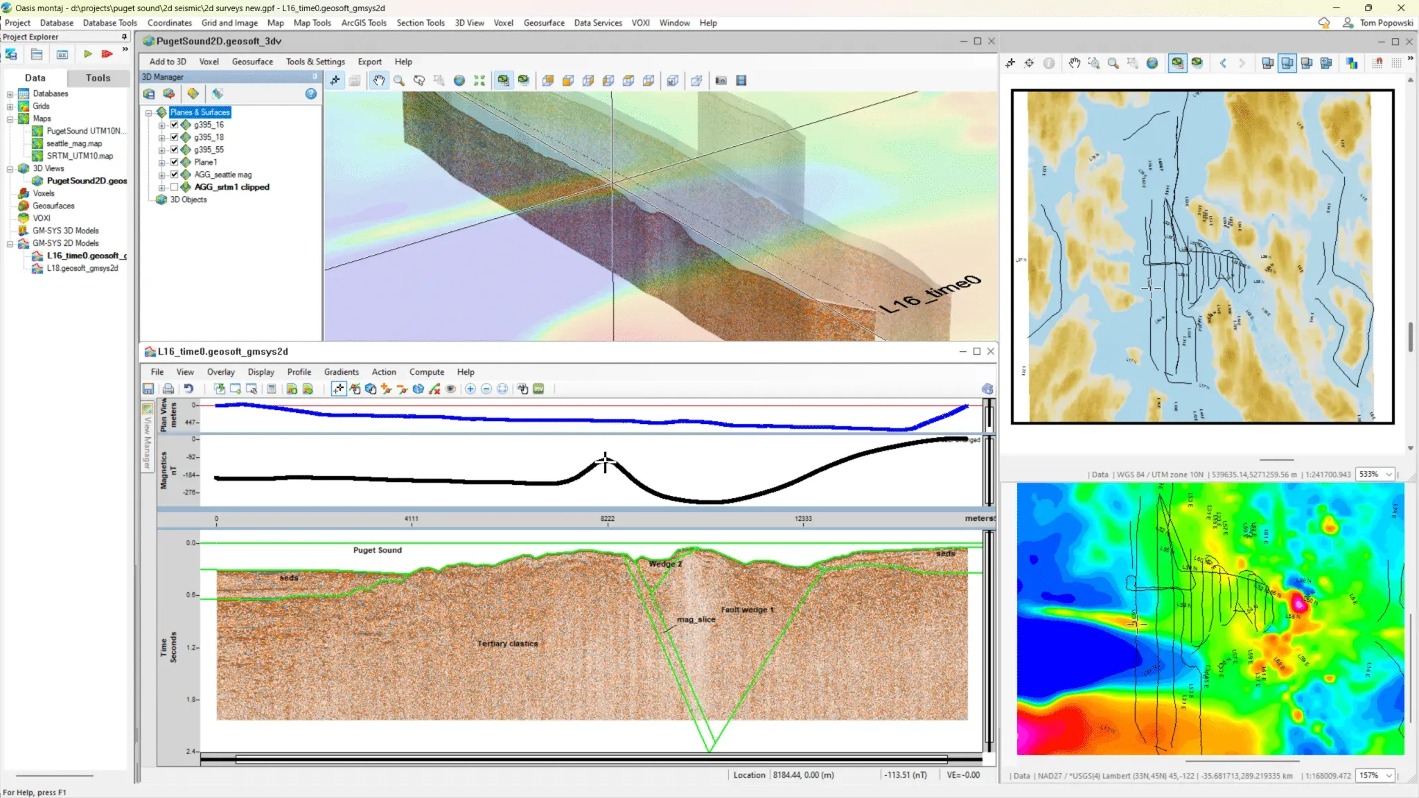
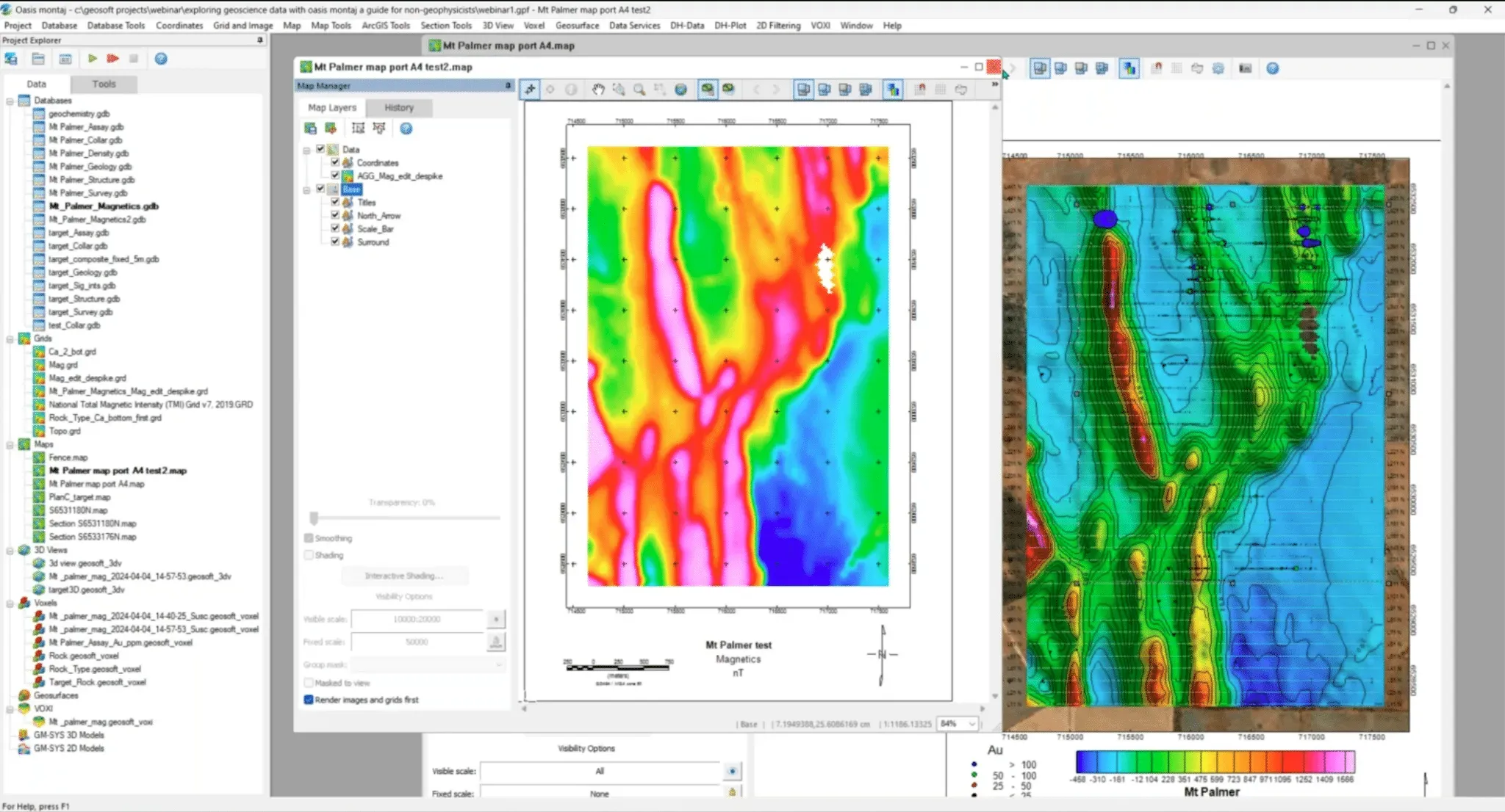
Use Oasis montaj to filter and process gravity, magnetic, and electromagnetic survey data. Supporting a broad range of geophysical workflows and data formats, Oasis montaj makes it easy to import and georeference data with user-friendly tools for coordinate system transformations, filtering, and visualising (gridding) the data.
Oasis montaj for energy applications
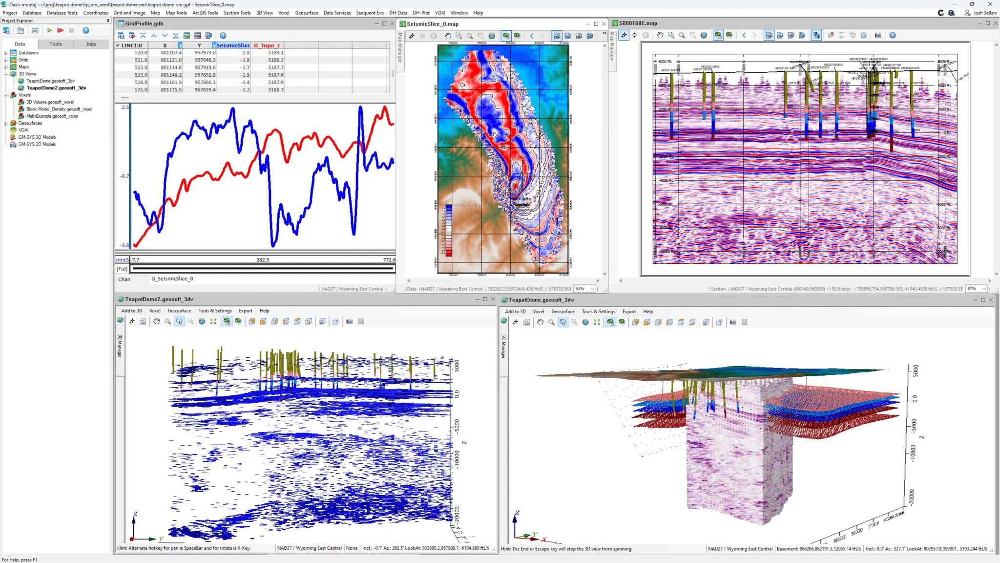
Oasis montaj Basin Modelling includes all the processing functionality of Oasis montaj plus additional tools for energy exploration. Create robust basin models by integrating geophysical data with seismic, well, and geological constraints to refine and validate your 2D geophysical models. Apply data corrections and 2D Fourier filters to clean, transform, and enhance your data and interpretation.
A comprehensive bundle
Oasis montaj Ultimate provides full access to all Oasis montaj tools and extensions, including the Resistivity and Induced Polarisation (DC-IP) Extension and radiometric processing tools. It features advanced gravity and magnetic capabilities, such as 3D layered-earth modelling and depth-to-source estimation, ensuring thorough and precise geophysical analysis.
Key Benefits
Large-scale data handling
Import, process, and manage large volumes of varied geoscientific data types and formats without database size constraints.
Industry-trusted solutions
Widely recognised and accepted for tenders by governmental and private companies, with industry-standard database and grid formats available for download from governmental data services.
Unified workflows
Streamline geophysical workflows with tools for acquiring, processing, and interpreting survey data. Create detailed models that integrate seamlessly with Leapfrog and share results via Central for efficient collaboration and data management.
Coordinate transformations
On-the-fly reprojection allows you to effortlessly combine geospatial datasets that use different coordinate reference systems.
Gridding and visualisation
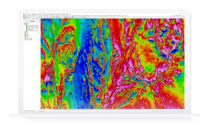
Create and visualise 2D and 3D geophysical data grids, interpolate data with advanced gridding methods, and merge geophysical grids quickly and accurately.
Advanced filtering
Apply a wide range of filters or use the math expression builder to process and analyse data to improve the precision of your interpretations.