
MicroSurvey CADHexagon
MicroSurvey CAD is a calculation-focused platform designed to maximise efficiency by supporting many data formats.
Vendor
Hexagon
Company Website

MICROSURVE…AD_2015Web.pdf
Product details
Overview
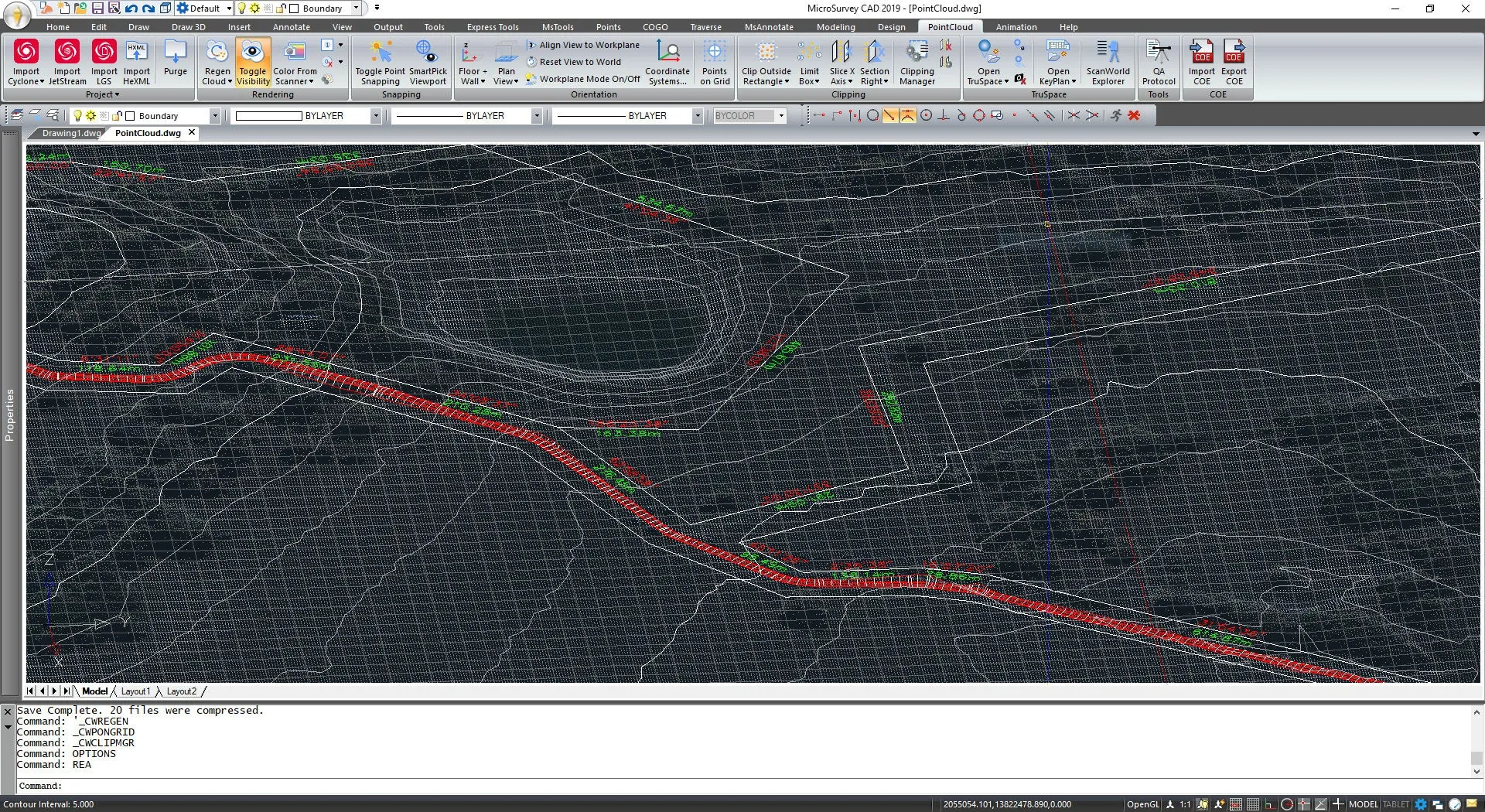
MicroSurvey CAD is a comprehensive, calculation-focused CAD platform tailored for land surveyors and engineering professionals. It is designed to enhance efficiency and value by supporting a wide range of workflows and data formats within a single program. The software facilitates seamless integration from field data collection to final deliverables, accommodating various data sources such as total stations, GNSS, UAVs, scanners, and photogrammetry. By utilizing the "Field to Finish" process, users can effortlessly create drawings directly from fieldwork, streamlining the transition from data collection to project completion.
Features and Capabilities
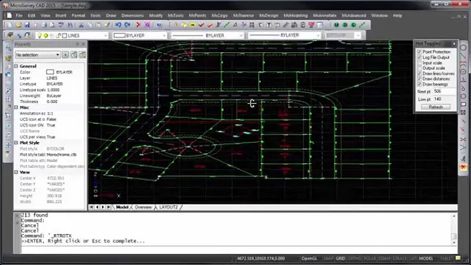
- Integrated Survey, Design, and CAD: MicroSurvey CAD Premium encompasses all necessary survey calculations, design, and drafting functionalities without the need for additional modules. This all-in-one solution enables users to manage the entire workflow, from downloading data collectors to plotting finished drawings.
- AutoCAD Compatibility: The software is compatible with AutoCAD files, storing all files in the industry-standard .dwg format. This ensures seamless interoperability without the need for file conversions. MicroSurvey CAD also supports shape files, fonts, linetypes, and hatch files from AutoCAD, maintaining consistency across platforms.
- Powerful Survey, Geodetic, and Geospatial Data Routines: The platform includes robust COGO functions, such as Batch COGO, allowing users to build and replay complex calculations as needed. It also offers Helmert's Transformation for rotating, shifting, and scaling large datasets based on best-fit solutions, and supports various coordinate transformations, including UTM, 3TM, and SPC.
- Active Drawing Technology: This feature enables real-time updates and intelligent object management within drawings, facilitating efficient editing and data management. Smart CAD entities allow for simultaneous creation of points, lines, and labels, streamlining the drafting process.
- Surface Modeling and Corridor Design: MicroSurvey CAD provides tools for 3D surface representation and computation, as well as corridor design, supporting complex engineering and construction projects. These features assist in tasks such as volume reporting, pad building, and alignment design.
- Point Cloud Management: Specialized tools allow for efficient handling and processing of point cloud data, enabling users to work with large datasets derived from modern surveying technologies. This capability supports the integration of data from various sources, including scanners and photogrammetry.
- GIS Data Import and Export: The software supports the import and export of GIS data, facilitating integration with other geospatial platforms and enhancing data interoperability. This feature ensures that users can work seamlessly with various data formats required in different projects.
- Imagery Service Connections: Users can connect to imagery services, allowing for the incorporation of background images and enhancing the visual context of projects. This integration aids in better visualization and planning.
- Familiar CAD Functionality: Built on the IntelliCAD engine, MicroSurvey CAD offers a user-friendly interface with familiar CAD functionalities, reducing the learning curve for new users and ensuring a smooth transition from other CAD platforms.
Find more products by industry
UtilitiesReal EstateProfessional ServicesPublic AdministrationConstructionView all