
Interactive indoor mapping platform providing real-time navigation, wayfinding, and data integration for complex indoor environments.
Vendor
MapsPeople
Company Website
YouTube
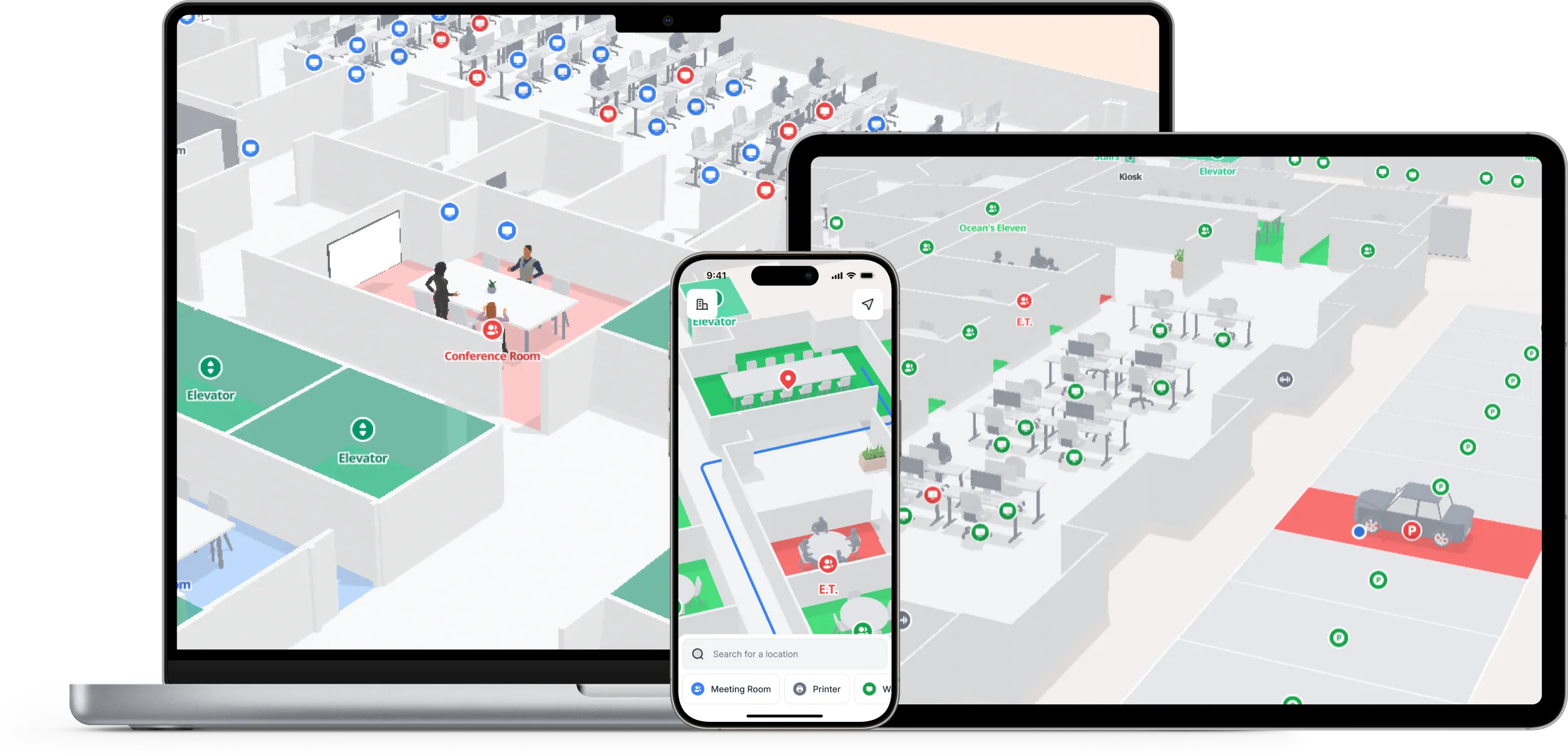
MapsIndoors is a cloud-based indoor mapping platform designed to provide interactive, real-time navigation and wayfinding within large and complex buildings. It enables organizations to create digital maps of indoor spaces, integrate live data, and offer seamless navigation from outdoor to indoor environments. The platform supports 2D and 3D mapping, real-time updates, and extensive customization, making it suitable for use cases such as airports, offices, hospitals, universities, stadiums, and event venues. MapsIndoors can be integrated into existing solutions via SDKs for web, iOS, Android, Flutter, and React Native, or used as a standalone web application. Its content management system (CMS) allows for instant map updates, ensuring accuracy and relevance for users.
Key Features
Interactive 2D/3D Mapping Provides both simple 2D and advanced 3D indoor maps, geo-referenced to real-world coordinates.
- Supports detailed visual representation of venues.
- Customizable look, feel, and branding.
Real-Time Wayfinding and Navigation Offers seamless navigation from outdoor to indoor spaces with dynamic route adjustments.
- Turn-by-turn directions within and between buildings.
- Personalized and accessible routes for different user needs.
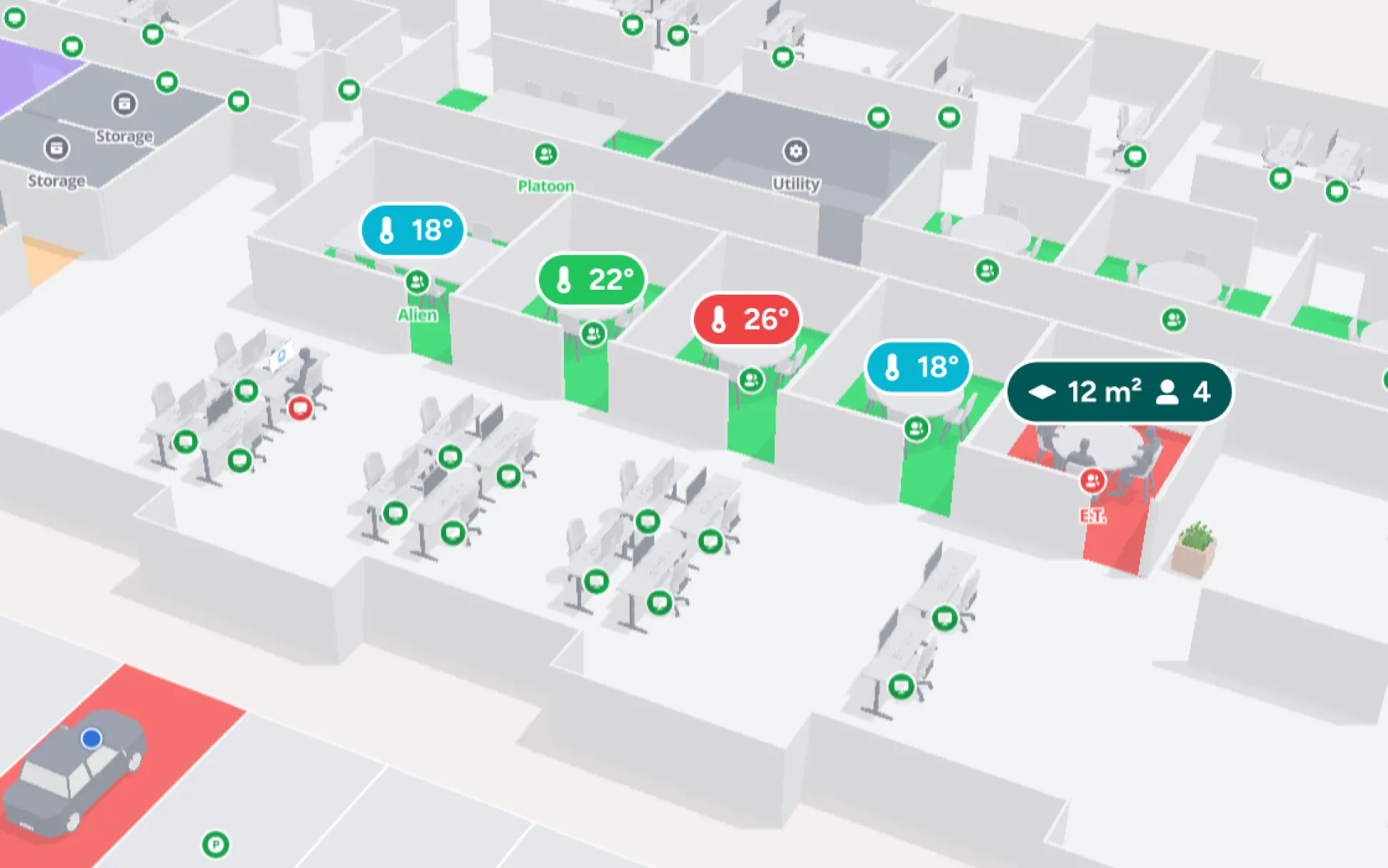
Live Data Integration Visualizes real-time data from sensors, booking systems, and other sources directly on the map.
- Centralizes live information (e.g., occupancy, environmental data).
- Enables context-aware digital twins for buildings.
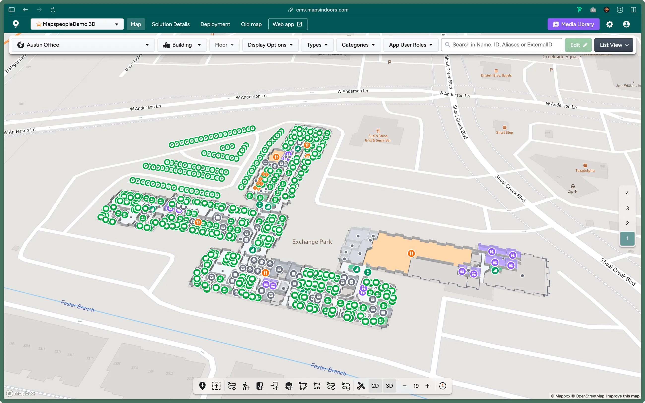
Content Management System (CMS) Allows for easy, instant updates to maps, including styling and content.
- Self-service updates without back-and-forth communication.
- AI-powered automation for floor plan changes.
SDKs and Integration Options Supports integration via native SDKs for web, iOS, Android, Flutter, and React Native.
- Embeddable as a web app, iframe, or through source code.
- Open APIs for third-party data and IoT device integration.
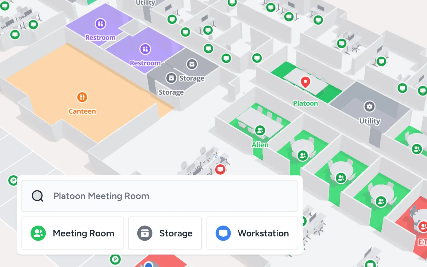
Advanced Search and Filtering Customizable search functionality for points of interest, categories, and areas.
- Clickable and named map elements.
- Filters for specific venues, floors, or types (e.g., restrooms, workstations).
Accessibility and Personalization Provides accessible navigation for users with visual, hearing, or mobility needs.
- Compliance with regulations (e.g., European Accessibility Act).
- Personalized map content and routing based on user roles.
Benefits
Enhanced User Experience Improves wayfinding and access to information in large, complex venues.
- Reduces confusion and time spent navigating.
- Increases satisfaction for visitors and staff.
Operational Efficiency Centralizes spatial data and live information for better decision-making.
- Reduces maintenance time with automated updates.
- Optimizes resource allocation and reduces delays.
Flexible Integration and Customization Adapts to diverse environments and branding requirements.
- Integrates with existing digital solutions and infrastructure.
- Supports multiple use cases across industries.
Scalability and Reliability Handles high traffic and large venues with robust performance.
- 99.99% uptime and global API responsiveness.
- No upper limit for map loads or updates