
Leica Pegasus OFFICEHexagon
Deliver high-resolution point clouds with classification, anonymised images and exchangeable formats in one batch-process.
Vendor
Hexagon
Company Website
Leica Pega…0624 en LR.pdf
Product details
Overview
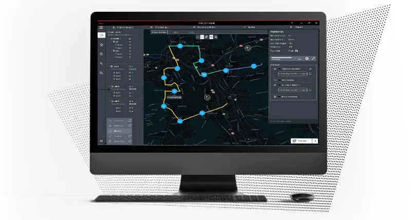
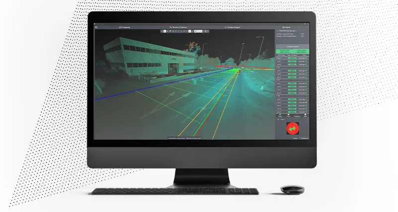
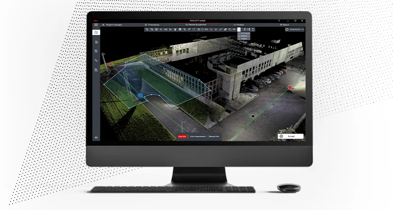
Leica Cyclone Pegasus OFFICE is a comprehensive software solution designed to streamline the processing and management of mobile mapping data. It offers a user-friendly interface that facilitates the efficient handling of large-scale 3D point cloud data captured by mobile mapping systems. The software automates various tasks, including data registration, trajectory adjustment, and point cloud classification, thereby enhancing productivity and ensuring high-quality deliverables. With its robust features, Cyclone Pegasus OFFICE is an essential tool for professionals in surveying, engineering, and construction sectors.
Features and Capabilities
- Automated Data Processing: Streamlines the processing of mobile mapping data, reducing manual intervention and accelerating project timelines.
- Precision Geo-Referencing: Ensures accurate spatial alignment of point clouds through advanced geo-referencing techniques.
- Multi-Pass Trajectory Adjustment: Refines data by adjusting trajectories across multiple passes, enhancing the overall quality of the point cloud.
- Photo-Realistic Texturing: Enriches point clouds with high-resolution textures, providing realistic visual representations of scanned environments.
- User-Friendly Interface: Features an intuitive interface that simplifies complex data processing tasks, making it accessible to users with varying levels of expertise.
- Comprehensive Data Management: Offers tools for efficient organization, storage, and retrieval of large datasets, facilitating seamless project management.
- Advanced Classification Tools: Includes robust classification capabilities, allowing users to categorize point cloud data effectively for various applications.
- Integration with Leica Hardware: Seamlessly integrates with Leica Geosystems' mobile mapping hardware, ensuring compatibility and optimized performance.
- Support for Multiple Data Formats: Accommodates various data formats, providing flexibility in handling diverse data sources.
- Real-Time Feedback: Provides immediate feedback during data processing, enabling users to make informed decisions and adjustments promptly.
- Batch Processing Capabilities: Supports batch processing, allowing for the simultaneous handling of multiple datasets to improve efficiency.
- Cloud Integration: Facilitates cloud-based data storage and collaboration, enhancing accessibility and teamwork.
- Customizable Workflows: Allows users to tailor workflows to specific project requirements, offering flexibility and adaptability.
- Comprehensive Documentation and Support: Provides extensive documentation and customer support to assist users in maximizing the software's capabilities.