
Leica GNSS Spider SoftwareHexagon
Leica GNSS Spider is a web-based solution for managing real-time and post-processing GNSS services.
Vendor
Hexagon
Company Website
Leica_GNSS_Spider_BRO.pdf
Leica-Geos…chure_0422.pdf
Product details
Overview
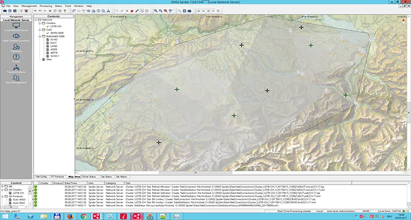
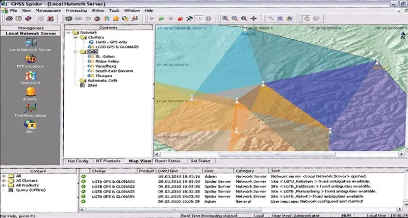
Leica GNSS Spider is an integrated software suite designed for the centralized control and operation of GNSS reference stations and networks. Its modular and scalable architecture allows customization to meet various applications, including GNSS surveying, seismic, and structural monitoring. The advanced SpiderNET solution offers long-range, high-accuracy Network RTK and centralized data distribution, while the Spider Business Center portal provides robust and secure access management.
Features and Capabilities
- Modular and Scalable Architecture: Tailor the software to specific needs, accommodating a range of applications from GNSS surveying to structural monitoring.
- Advanced Network RTK with SpiderNET: Deliver long-range, high-accuracy Network RTK services, enhancing positioning performance over extensive areas.
- Centralized Data Distribution: Efficiently manage and distribute data across the network, ensuring seamless access and reliability.
- Spider Business Center Portal: Provide secure and powerful access management, facilitating user authentication, authorization, and accounting for network services.
- Comprehensive Receiver Support: Integrate with various GNSS receivers, including Leica System 1200, GMX900 Series, and System 500 GNSS receivers, ensuring compatibility and flexibility.
- Flexible Communication Methods: Support multiple communication channels, data formats, and authentication methods, allowing customization to specific operational requirements.
- Automated Operation: Once configured, services run automatically and autonomously, integrated within the operating system, ensuring continuous and reliable operation.
- Real-Time and Post-Processing Services: Offer both real-time data services and post-processing capabilities, providing versatility in data handling and analysis.
- Quality Control and Data Logging: Implement quality control measures and support RINEX logging with FTP distribution, ensuring data integrity and accessibility.
- User-Friendly Setup and Configuration: Utilize setup wizards and drag-and-drop functionality to create new sites and configure networks, simplifying the initial setup process.
- Support for Multiple GNSS Systems: Enhance positioning accuracy by supporting multiple GNSS systems, including GPS and GLONASS, and integrating additional constellations like Galileo and BeiDou.
- Comprehensive Monitoring and Reporting: Provide tools for monitoring service usage, exchanging data, viewing online network and rover status, and assisting with support and accounting.