Advanced GIS SDK with powerful lidar, terrain, and photogrammetry tools for custom geospatial applications.
Vendor
Blue Marble Geographics
Company Website
Overview
The Global Mapper Pro SDK is an advanced geospatial software development kit designed to provide developers with comprehensive tools for integrating sophisticated GIS functionalities into their applications. Building upon the capabilities of the standard Global Mapper SDK, the Pro version offers enhanced features such as advanced point cloud processing, terrain analysis, and photogrammetric tools. It supports Python scripting, enabling automation and customization of geospatial workflows. The SDK is compatible with various programming languages on the Windows platform, including Visual C++, Visual Basic, and Visual C#. This makes it a versatile solution for developers aiming to incorporate robust GIS capabilities into their software.
Features and Capabilities
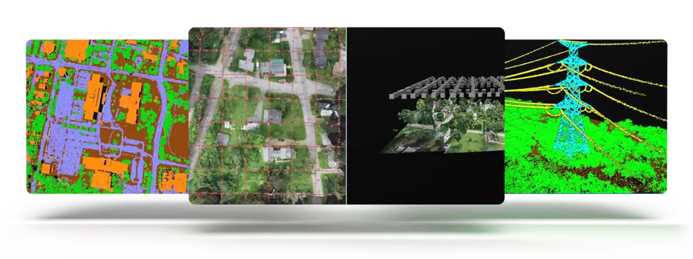
- Advanced Point Cloud Processing: Access to powerful lidar classification tools, including automatic classification of ground, building, vegetation, power lines, utility poles, and noise points.
- Photogrammetry API (Pixels-to-Points): Transform overlapping drone images into 3D point clouds, enabling detailed terrain and object modeling.
- Terrain Analysis Tools: Advanced elevation grid creation methods, manual terrain editing, automatic breakline creation, and raster vectorization tools.
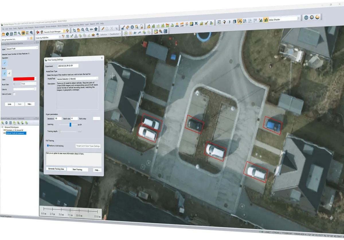
- Python Scripting Support: Develop and run Python scripts within the Global Mapper Pro application for workflow automation and customization.
- Lidar Filtering and Smoothing: Improved lidar filtering for large point clouds, reducing data loss, and smoothing functions for enhanced data quality.
- Feature Extraction: Automatic extraction of building outlines, tree points/polygons, and powerline features from point cloud data.
- Spatial Operations: Support for spatial operations and predicates on layers, enabling the creation of new layers or collections of features based on spatial queries.
- 3D Visualization: Display of 3D views with terrain and vector features, along with data draped on the terrain surface.
- Data Format Support: Ability to load and manipulate a wide range of raster, vector, and elevation data formats, including support for online WMS sources.
- Performance Optimization: Enhanced processing speeds for drone image processing, especially on machines with NVIDIA GPUs, and reduced SDK installation size requirements.