
Field-ready GIS app for mobile data collection and mapping—ideal for surveyors and geospatial professionals.
Vendor
Blue Marble Geographics
Company Website
Overview
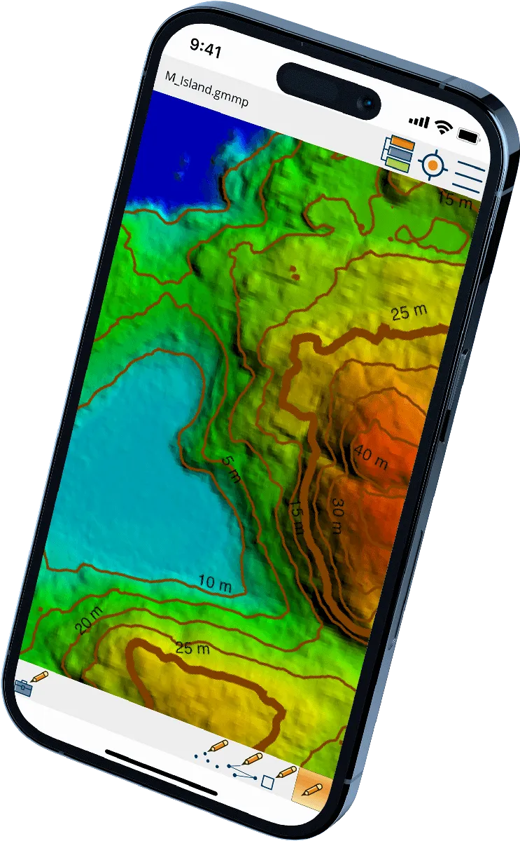
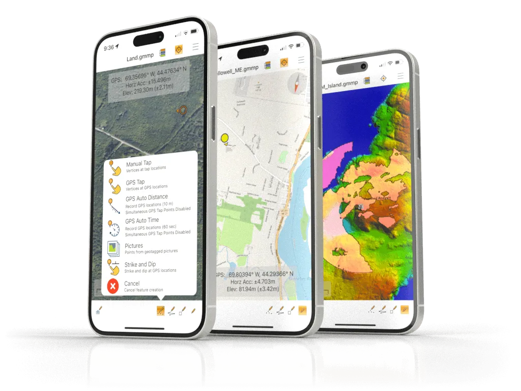
Global Mapper Mobile is a robust GIS application designed for iOS and Android devices, enabling users to view and collect geospatial data in the field. It leverages the GPS capabilities of mobile devices to provide situational awareness and locational intelligence for remote mapping projects. As a companion to the desktop version of Global Mapper, the mobile app offers "maps-in-hand" functionality, making it an essential tool for engineers, surveyors, wildlife managers, foresters, drone/UAV teams, and others who require access to spatial data in remote locations. The application supports the display of vector, raster, and elevation data layers transferred from the desktop version or streamed from available online sources. It also includes tools for manual feature digitizing, GPS tracklog creation, and form-based attribute collection using pre-configured attributes and picklists.
Features and Capabilities
- Platform Compatibility: Available on both iOS and Android devices.
- Data Viewing: Supports vector, raster, and elevation data layers.
- GPS Integration: Utilizes device GPS for real-time location tracking and data collection.
- Data Collection Tools:
- Manual feature digitizing (points, lines, polygons).
- GPS tracklog creation.
- Form-based attribute collection with pre-configured attributes and picklists.
- Photo Integration: Allows tagging of photos taken with the mobile device to features.
- Offline Functionality: Once maps are transferred to the device, data can be collected without an internet connection.
- Pro Version Enhancements:
- Advanced GPS support, including connection to external high-accuracy Bluetooth GPS devices.
- Ability to view satellites, detailed location information, and NMEA streams.
- Terrain shader selection and water level display on terrain data.
- Contour line generation from loaded terrain data.
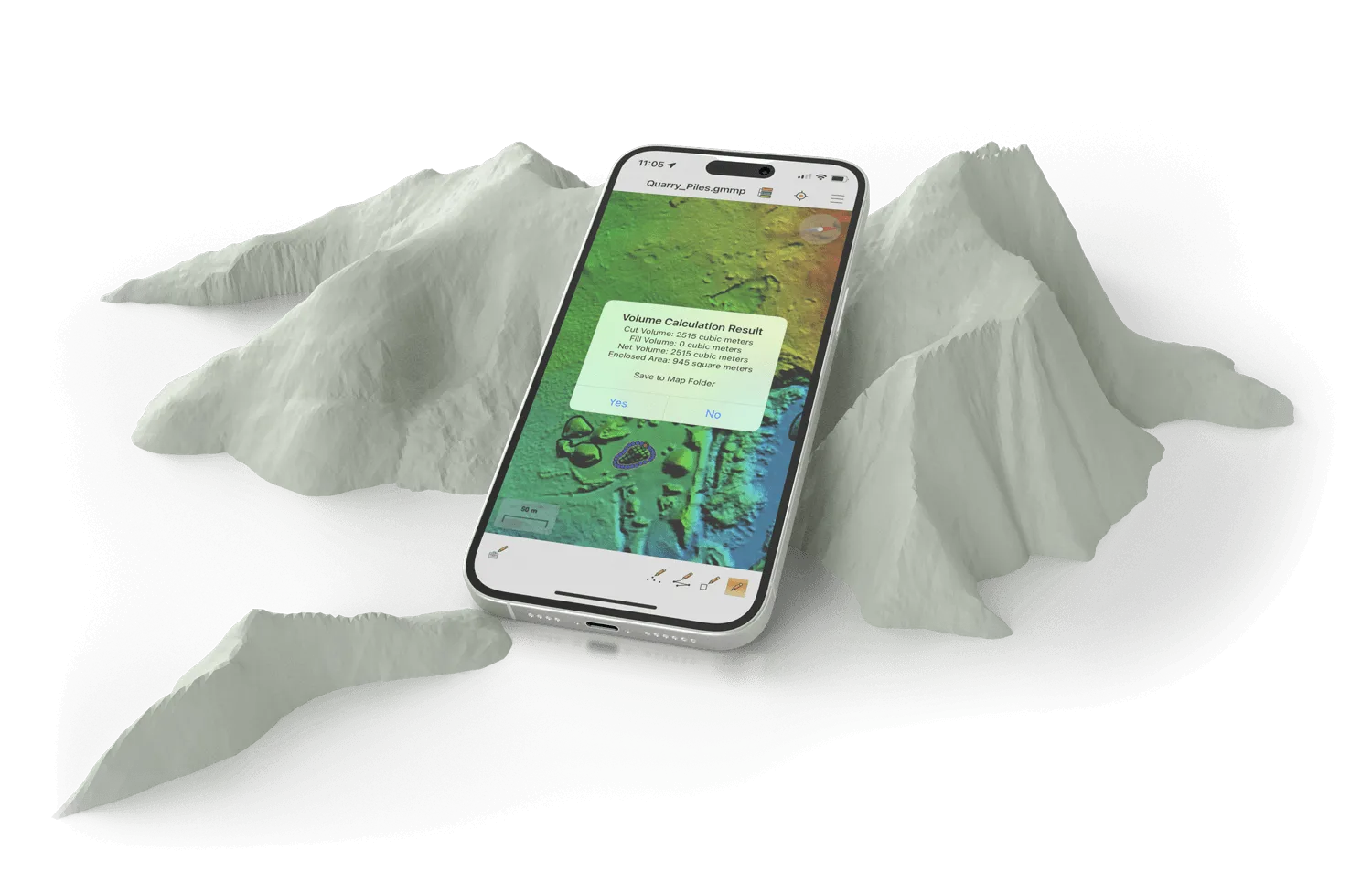
- Volume calculation tools for vector areas.