
FNT GeoMaps enhances cable and outside plant management with geospatial visualization and analysis. It integrates FNT's infrastructure data with Esri's location intelligence, optimizing network capacity, resiliency, and efficiency both inside and outside buildings.
Vendor
FNT
Company Website
FNT GeoMaps
Cable management enhanced with location-based visualization and analysis of network resource data
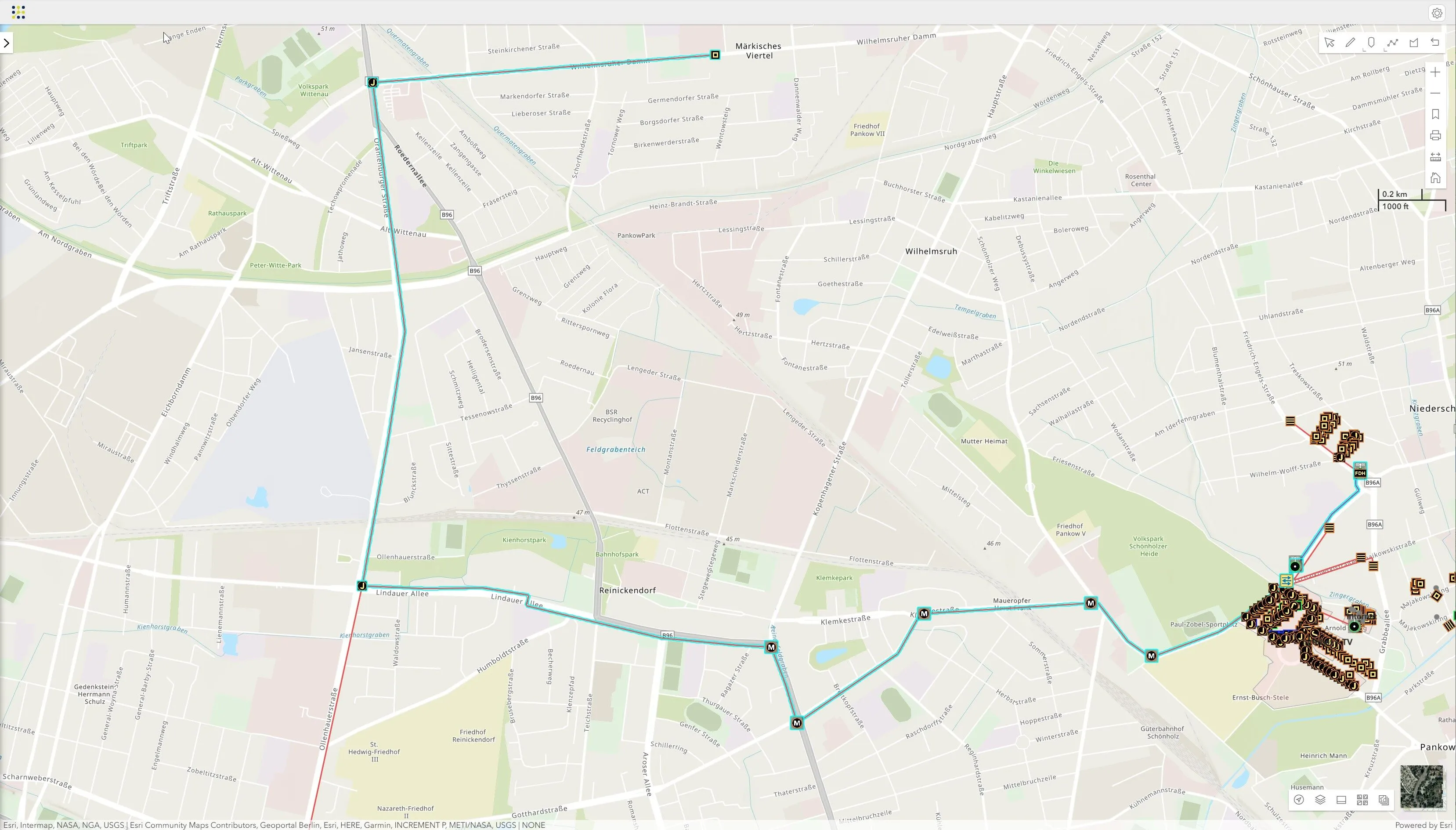
FNT GeoMaps provides expanded functionality to ensure cable and network infrastructures are optimized end-to-end. It gives users much-needed transparency into their passive network infrastructure, both inside buildings and between buildings and facilities, by combining FNT’s Cable and Outside Plant Management solution with Esri’s geospatial tools. This powerful combination delivers fully integrated cable management and GIS capability to enable knowledge-based decisions about critical infrastructure.
Adding geospatial intelligence optimizes network infrastructure management both outside and inside buildings
Geospatial readiness is an important enabler of digital innovation. Combining location intelligence with network infrastructure details supports smarter decisions about network capacity, resiliency and efficiency. FNT GeoMaps combines FNT's deep cable and outside plant management capability with Esri's location data and analytics. The joint solution leverages the unique benefits of each to deliver a best of breed cable and outside plant management solution. It applies FNT’s infrastructure data to maps from Esri’s ArcGIS, which users can use to:
- Perform georeferenced planning of network infrastructure
- Apply location intelligence to speed up and improve output of operational tasks
- Manage sites with their connection details
- Leverage information and views that simplify complex capacity management applications FNT GeoMaps also applies network infrastructure data to building representations. Inhouse visualization capabilities allow seamless navigation from outdoors to inside buildings, where 2 and 3D models of buildings show precisely where infrastructure objects are located, by building and floor layer. This 3D visualization is an enhancement to the digital twin of the network infrastructure. It provides a unique view of the network that dramatically improves the utility of the documentation. Georeferenced inhouse cable management depicts where cables and other passive equipment are within a building. These point of presence views inside buildings:
- Display infrastructure objects on floor plans, according to their location and height
- Supports navigation with different perspectives and different options of building representation
- Are available with various filter options and a separate building navigation
Visualization brings cable network asset and resource data to life
Digitalization and interconnectivity heighten the need for geospatial content and solutions. Applying location-based analytics to cable management processes enables users to perform important tasks faster, more efficiently and with better results As companies upgrade networks, roll out 5G and lay new fiber, they require full transparency into all network resources. FNT GeoMaps adds the much-needed spatial dimension and locational context to better manage digital infrastructures and interconnected systems. The combination of location intelligence and network infrastructure details enables more informed decision making about network capacity, rollout priority, routing and redundancy. Companies that use FNT GeoMaps operate a more resilient network - one that is highly resistant to disruption, can be quickly restored if disruption does occur, and able to scale with changing demands.
Benefits
- Fully integrated into FNT Cable and Outside Plant Management solution. Users can work in a single, fully equipped cable management system with high-end GIS functionality.
- Easy access to graphical documentation of any type of cable network infrastructure. Can both create web-based digitization of nodes and trays on georeferenced maps, as well as create data without any map interaction and visualize it later on maps according to the loaded geo-coordinates.
- Offers a wide range of common geo-formats. Enables the integration of inventory data (document drawings, specific background data) and an easy migration of existing material.
- Visualize end-to-end signal paths. The GeoMaps viewer displays graphical replication of signal tracing across the entire network infrastructure.