
EDR Historical Topographic MapsLightBox
Advanced mapping solutions that assist environmental professionals in evaluating potential liabilities from past activities.
Vendor
LightBox
Company Website
Product details
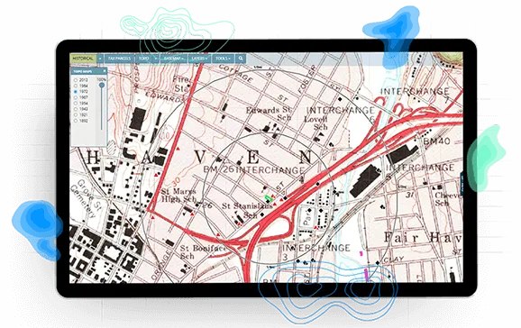
The EDR® Historical Topographic Maps service provides access to a comprehensive collection of U.S. Geological Survey (USGS) historical topographic quad maps, dating back to the early 1900s. Utilizing the QUADMATCH® feature, this service enables environmental professionals to efficiently review and assess potential environmental liabilities associated with historical land use. By overlaying historical maps onto current property data, users can identify past activities that may have impacted the site, facilitating more informed decision-making during environmental assessments.
Key Features and Benefits:
- Comprehensive Historical Data: Access to USGS historical topographic maps from the early 1900s to the present, providing a detailed view of land use changes over time.
- QUADMATCH® Technology: An advanced mapping solution that intelligently presents historical topographic quad maps, streamlining the evaluation process.
- Enhanced Due Diligence: Facilitates the identification of potential environmental liabilities arising from past activities, supporting thorough environmental assessments.
- User-Friendly Interface: Designed for ease of use, allowing professionals to efficiently overlay historical maps onto current property data for comprehensive analysis.